
 MLS 25560125 · Unincorporated LA County · APNs 2064-005-011 & -015
Santa Monica Mountains · 30.05 acres · Open space
27300 Agoura RoadCalabasas 91301 · unincorporated Los Angeles County
Thirty acres of hillside rising from the south side of Agoura Road at Liberty Canyon, with the 101 at its feet and the Liberty Canyon wildlife corridor next door. The County has designated most of it permanent open space — this page says so first, and puts the record behind it.
Offered at$1,250,000
- 30.05 acrestwo parcels · Assessor
- 27.43 acO-S zone · OS-C open space
- 2.62 acCPD zone · Agoura Rd frontage
- 100% SEASignificant Ecological Area
- No loansof record · title report
- Next doorLiberty Canyon wildlife corridor
What the land is
Scale, permanence and a view the County has promised to keep.
Most listings lead with what could be built. This one leads with what the County has already decided, because that is what every buyer’s lawyer, lender and appraiser will read first — and because a buyer who knows it on day one is a buyer who closes.
- Two parcels
APN 2064-005-011 is 27.43 acres — Lot 3 of Tract 33128 — the long hillside between Liberty Canyon Road and the Lost Hills Sheriff’s Station. APN 2064-005-015 is 2.62 acres of frontage on the south side of Agoura Road. Together, 30.05 acres per the Assessor. The County has assigned no situs address; “27300 Agoura Road” is how the land is marketed.
- The designations
The 27.43-acre parcel is zoned O-S, Open Space, and designated OS-C, Open Space–Conservation, in the County’s 2021 Santa Monica Mountains North Area Plan — land the Plan describes as “preserved in perpetuity.” A house is not a permitted use. The 2.62-acre frontage is zoned CPD, Commercial Planned Development, and designated CR, Rural Commercial, where any use requires a conditional use permit.
- The overlays
All of it lies in the Santa Monica Mountains Significant Ecological Area and the North Area Community Standards District; most of it is in a Hillside Management Area; Agoura Road is a designated scenic route; and the site is in a Very High Fire Hazard Severity Zone. The land-use summary gives the slope and buffer percentages for each parcel.
- The setting
Directly across the Liberty Canyon Road intersection, the Wallis Annenberg Wildlife Crossing carries the Liberty Canyon corridor over the 101 onto public open space held by the Mountains Recreation and Conservation Authority and the Santa Monica Mountains Conservancy. This land sits in the same Significant Ecological Area, on the eastern flank of that corridor.
- Who it suits
A conservation agency or land trust completing the corridor; an adjacent owner who wants a protected buffer and the view that comes with it; or a long-term holder who understands the designations and values thirty acres of permanence twenty-five miles from downtown Los Angeles. Seller will consider financing or a lease.
The file
The record, organized the way a buyer reads it.
These are the documents in hand. Each one says, in plain language, why it matters. Nothing is summarised from a document we have not read, and the items still being obtained are listed at the end rather than left out.
Open the document folderAll 6 documents in one shared folder — view or download without signing inLand Use and ZoningWhat the County says the land is, in one document.1
TitleConsumers Title Company of California, agent for First American. Effective June 25, 2025.4
Maps and OrientationFor finding your way on the ground. Not a boundary.1
Requested — not yet on fileListed so you know what exists and what is coming. Nothing here is summarised from a document we have not read.5
6 documents on file · updated 26 September 2026
Before you offer
What is not settled, and what is not on offer.
Every one of these is in the record or the tracker behind this page. We would rather you read them here than discover them in escrow.
- No entitlements
Nothing has been applied for or approved by the current owner. A prior owner's solar-farm application and a residential concept were not approved by the County, and his federal suit against the County over the site concluded in 2024. Residential use of the 27.43-acre parcel would need, at minimum, an Area Plan amendment and zone change voted by the Board of Supervisors, a Significant Ecological Area permit and CEQA review. We make no prediction that any of it would be approved.
- The 1985 covenant
A “Covenant and Agreement Pertaining to the Development of Said Land” is recorded against both parcels. We have requested a copy and have not read it. Treat it as potentially restrictive until you have.
- The 1991 option
A Memorandum of Option to Purchase recorded in 1991 has no release of record. It is a title-clearance item for the title company, and it is listed so it is not a surprise.
- Taxes, cured of record
A Notice of Power to Sell for a 2020-21 tax default was recorded in October 2024 against the larger parcel. Taxes are shown current today; confirmation that a rescission has been recorded is being requested.
- No survey
There is no boundary survey and no monumented corner. Acreage is the Assessor's: 27.43 plus 2.62, or 30.05 acres. Other figures you may see (“31” or “32.4” acres) are not supported by the record.
- Utilities unverified
Water and sewer mains of the Las Virgenes Municipal Water District, and electric, gas and communications lines, run in or along Agoura Road, and recorded utility easements cross the land. No will-serve letter exists, and availability, capacity and cost have not been verified.
- Fire and slope
The site is in a Very High Fire Hazard Severity Zone and inside the 2018 Woolsey Fire perimeter; annual brush clearance is required. Most of it is steeper than 25 percent, and parts are mapped in a state earthquake-induced landslide zone.
Los Angeles County Department of Regional Planning, Santa Monica Mountains section, is the authority on permitted uses for both parcels. Every offer will include a short buyer acknowledgment of the zoning, designations and site conditions described here.
Location
On Agoura Road, between Liberty Canyon and Lost Hills.
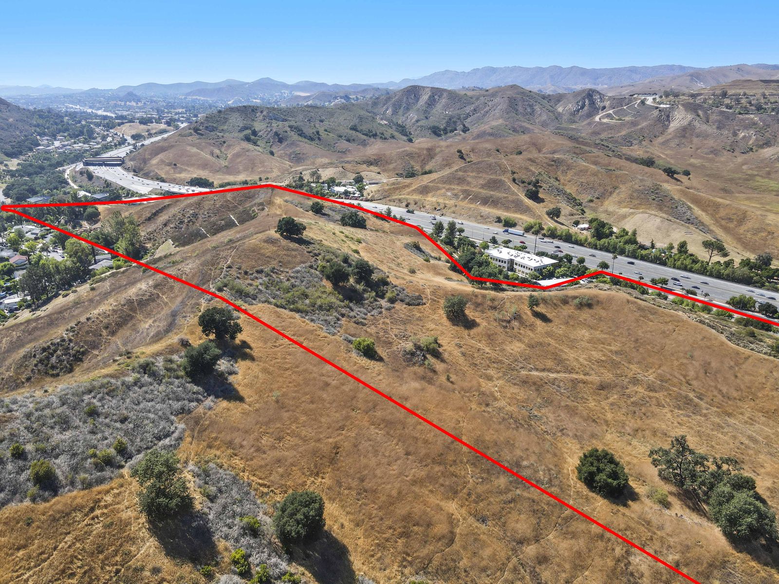
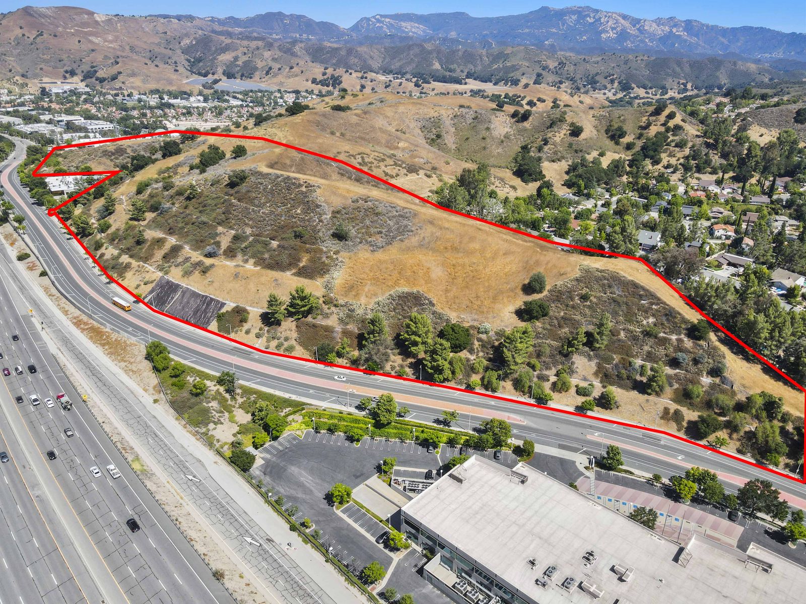
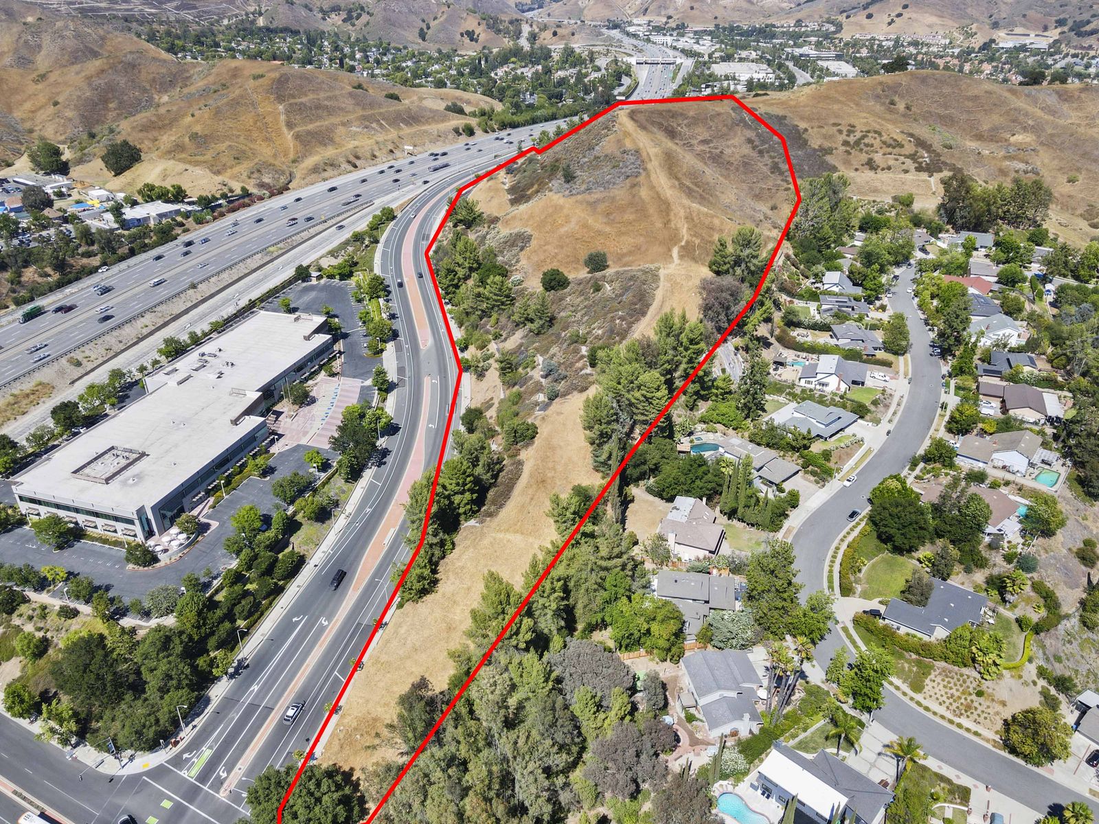
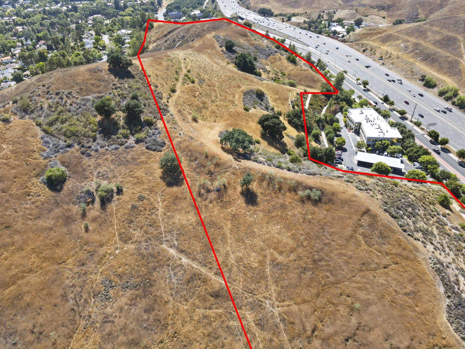
The land runs east from the south-east corner of Liberty Canyon Road and Agoura Road toward the Malibu/Lost Hills Sheriff’s Station, wrapping around the office building at 27200 Agoura Road, with the homes of Provident Road and Jim Bowie Road below its southern edge. It is vacant hillside with no structures and informal trails. Please view it from the Agoura Road shoulder or the Liberty Canyon corner, and do not enter without an agent.
From the air
Thirty acres, photographed from above.
Drone photography by Revepix, July 2025. The red lines are drawn for orientation only.
Parcel lines are indicative only — not a survey
All 16 photographs